Geographically, Bougainville is the principal island fo the northern group of the solomon islands archipelago.
The Autonomous Bougainville Region Consists Of 168 Islands With The Most Populated Being The Large Island Of Bougainville And The Smaller Island Of Buka To Its North, Separated By The Narrow Buka Passage. The Total Population Of The Region Is Estimated To Be In Excess 200,000.
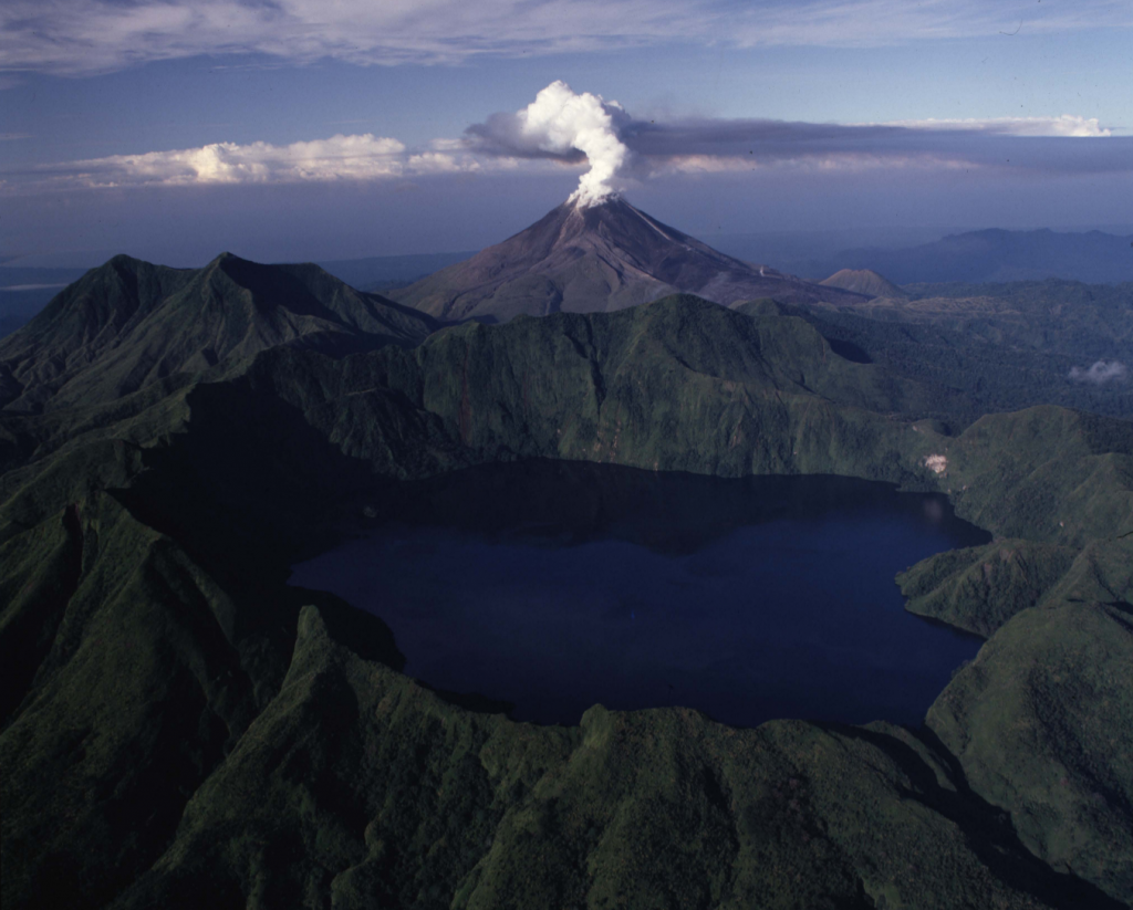
Geographically, Bougainville Is The Principal Island Of The Northern Group Of The Solomon Islands Archipelago. It Is About 190km Long And 50km Wide And Is A Place Of Great Nature Beauty.
Running North To South Is A Steep Mountain Range, In Parts More Than 2,500m High Including The Active Volcano Mt Bagana. The Keriaka Limestone Plateau South Of Mt Balbi Contains Benua Cave, One Of The Largest Underground Caverns In The World
The Other Major Groups Of Islands In The Autonomous Province Are Nukumanu, Takuu, Nuguria. Nissan And Tulun.
Bougainville Has Little Flat Land Except Around The Coastal Fringes And In The North. Its Fertile Areas Are Characterised By Rich Volcanic Soil And Cocoa Are Important Commercial Crops.
Until 1989, The Administrative And Commercial Capital Was Arawa, Situated Midway Along The East Coast And Accessed Through The Part Of Kieta And Aropa Airport.
Since The Crisis, Administration And Commerce Ahve Centred On Buka But The Autonomous Government Plans To Return Most Government Functions To Arawa In The Near Future.
The Former Panguna Mine Is Located In The Mountains West Of Arawa And Is Connected By A Sealed Access Road To The Port Of Loloho.